

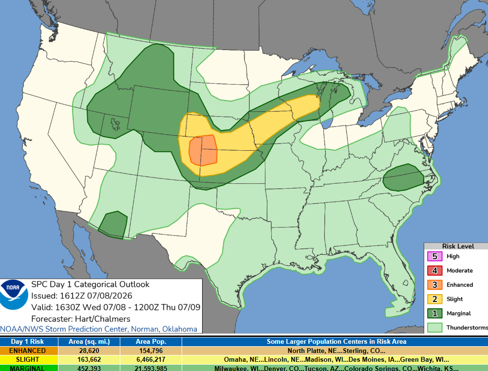
A weak and generally dry cold front will push through Wednesday allowing for breezy westerly winds of 15-25mph. The threat for thunderstorms is also a possibility, but mainly for southwest Montana where gusty, outflow winds remain the greatest concern.
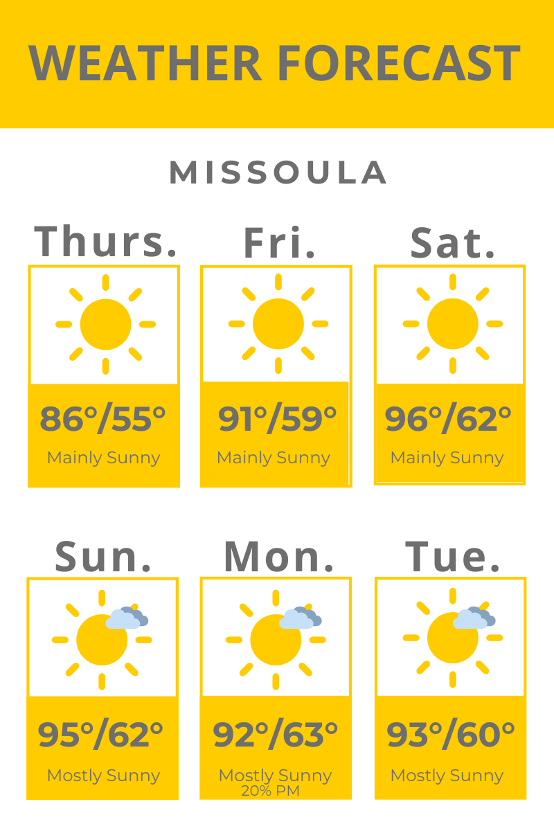
Our current ridge of high pressure will rebuild across the region the rest of this week and into the weekend with mainly sunny skies and highs on their way UP… by Sunday, we could be well into the 90s across the valleys of western Montana, with triple-digit heat expected in the lower Salmon and Clearwater river valleys, some of southwest Montana and for our friends in the eastern part of the state!
The National Weather Service says this stretch of significant heat “also introduces an increased heat risk for vulnerable populations, such as the elderly and the very young, prompting the potential issuance of Heat Advisories”. As of now, there’s a slight chance for temps in Butte to reach 100° on Sunday, which would tie an all-time historical record set on July 22, 1931.
Unfortunately, winds will be on the increase this weekend, too, and combined with low humidity values and these above average temps, fire danger will be elevated across the region.
The middle of next week could showcase the return of monsoonal moisture meaning widespread thunderstorms look to return to the forecast.
Thank you so much Erin! I'm a dog trainer and teach my classes outside in the summer, so I obsessively check weather forecasts every day. It helps to know what's coming up. I appreciate this!